
Sea to Sky Backcountry Maps
The most detailed topographic map available for the Stawamus Chief and Shannon Creek Basin.
Our adventure map is specially designed for ski touring, hiking, mountaineering, trail running, and climbing!
Brought to you by:

The Sea to Sky Backcountry Map is the most accurate and up to date backcountry adventure map available for the Sea to Sky Gondola and Squamish Chief.
Eric and Evan have spent combined decades exploring the peaks and pow above Howe Sound and now you can benefit from their experiences.
High resolution 1:12,000 scale - larger scale than any other map in the corridor.
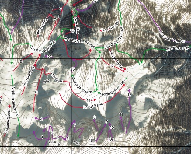
Covers 24 sq km including Stawamus Chief, Mt Habrich, Sea to Sky Gondola, Sky Pilot and the Ledge Basin.
31” x 21” map printed on waterproof/tearproof paper.
Primary goal of map design is clarifying safe access routes for ski touring/winter use.
Additional resources available on the website including downloadable digital tracks, additional topo photos and detailed descriptions.
High Resolution
30cm accuracy satellite imagery from March 2020, combined with custom DEM contour lines and our personal dataset of lines and routes.
Detailed Photos
Topo images for steep skiing along with clear descriptions to help you find your lines. A priority in designing the map was emphasizing safe access routes. We help you get there then you get to explore!
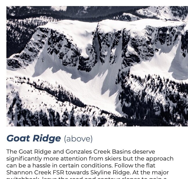
We detail important information about ski touring and summer exploration in the Sky Pilot area including some of our own tips and tricks. This is supplemented in the Read Me section of this website.
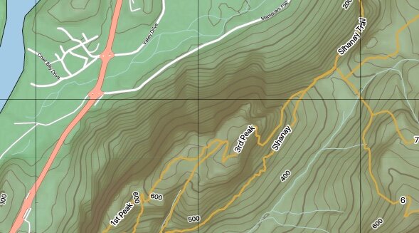
Stawamus Chief Trails
The most comprehensive map of the Stawamus Chief ever produced (and the only one currently in print). The goal is to help you make sense of the trail network and explore new routes! Summer trails on the Chief, Slahany, and Gondola areas are all included with ratings and descriptions.